
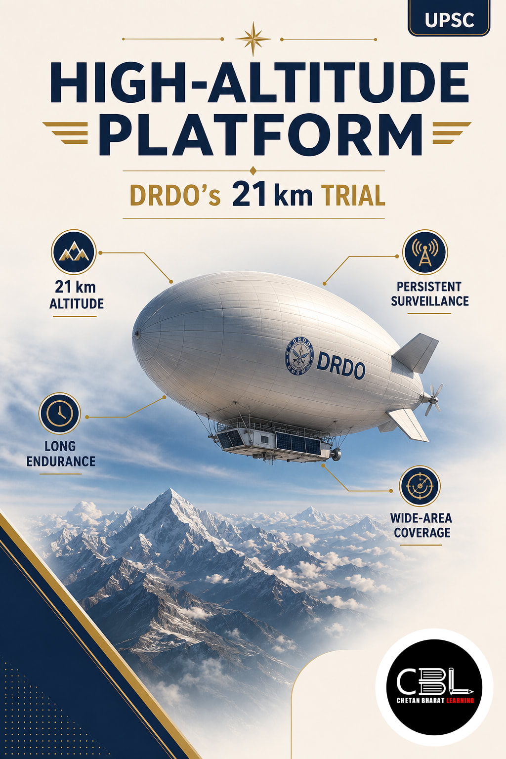

UPSC Mapping
| Prelims | Defence Technology and Stratosphere |
|---|---|
| Mains | GS Paper III: Science, Technology and Security |
Quick Facts
| Developer | ADRDE, Agra |
|---|---|
| Trial Date | 6 October 2026 |
| Peak Altitude | 21 km AMSL |
| Altitude Hold | 20 km for 30+ Minutes |
| Platform Type | Lighter-than-Air System |
What is a High-Altitude Platform?
It is an airborne system designed to operate for extended periods in the lower stratosphere. The tested Indian version is a lighter-than-air airship, which gains buoyancy from lifting gas rather than depending entirely on aerodynamic lift. Its intended role is to carry sensors, communication equipment and control systems above most weather while remaining much closer to Earth than an orbital satellite and easier to recover for inspection or upgrades.
The broader HAPS category can include airships, balloons and solar-powered fixed-wing aircraft, but their engineering approaches differ. Airships use buoyant envelopes and propulsion for station-keeping, whereas fixed-wing systems continuously generate lift through forward movement. Both concepts seek long endurance, wide-area coverage and recoverable payloads, although the October trial specifically concerned DRDO’s stratospheric lighter-than-air platform rather than a solar-powered aircraft.
Why is the High-Altitude Platform in News?
DRDO conducted a successful flight trial of the indigenous platform on 6 October 2026. It climbed to 21 km above mean sea level, maintained 20 km for more than 30 minutes and then descended under command after completing its planned high-altitude performance objectives. The system was recovered successfully, while engineers analysed the flight-performance data recorded during the mission.
The ground control station received real-time video and vehicle parameters throughout the flight. Onboard equipment included an inertial measurement unit, GPS receiver, cameras and an altitude-control mechanism. The official Ministry of Defence release identifies DRDO’s Aerial Delivery Research and Development Establishment in Agra as the designer and developer, working with defence, aviation and civil agencies during the trial.
Key Features
- Lighter-than-air design: A buoyant envelope supports the platform, reducing the continuous energy needed to remain airborne at operational altitude and allowing energy to focus on propulsion and payload operation.
- Stratospheric operation: Flight near 20 km places the system above commercial air traffic and much of the turbulent weather found below, although winds and thermal conditions still create demanding engineering requirements.
- Real-time monitoring: The platform transmitted video and vehicle parameters continuously to the ground control station during the experimental mission, allowing engineers to assess health and performance without waiting for recovery.
- Controlled flight: Navigation sensors, onboard electronics and an altitude-control mechanism supported ascent, altitude holding, commanded descent and recovery while recording the behaviour of critical subsystems throughout each flight phase.
- Modular mission potential: Future payloads could support surveillance, communications relay, disaster assessment, environmental observation and border monitoring through interchangeable sensor or communication packages.
A stratospheric platform occupies a useful operational middle layer. Aircraft and conventional drones offer mobility but usually need frequent refuelling or recovery, while satellites provide broad coverage from orbit but follow constrained paths and cost more to replace. A recoverable airship can potentially remain over a selected region, accept upgraded payloads and deliver lower-latency data to nearby users without launching a new orbital asset for every mission.
Its surveillance value depends on altitude, payload quality, communications bandwidth and station-keeping accuracy. From around 20 km, sensors can observe a large area because the platform has a wide line of sight. Communication payloads could also bridge damaged terrestrial networks during disasters, although actual service coverage would depend on terrain, antenna design, spectrum, atmospheric conditions, ground-terminal capacity and the security of its communication links.
Challenges
- Stratospheric winds: The vehicle must hold position despite changing wind direction and speed without exhausting its limited onboard energy or drifting outside the assigned mission area.
- Envelope durability: Lightweight materials must retain lifting gas and survive ultraviolet radiation, low pressure, severe temperature variation and repeated expansion or contraction during ascent and descent.
- Energy balance: Propulsion, communications, sensors and thermal control need dependable power during both daylight and extended night operations without exceeding the platform’s weight or thermal limits.
- Payload trade-offs: Larger sensors improve capability but add weight, increasing demands on buoyancy, structure, propulsion and energy storage while potentially reducing endurance and manoeuvring margins.
- Secure operations: Command links and data streams need protection from jamming, interception, cyber intrusion, deceptive navigation signals and unauthorised control across long-duration missions.
Turning the High-Altitude Platform into a long-endurance operational system requires progress in materials, energy, autonomy and airspace management. Engineers must progressively test longer flights, representative payloads, stronger winds and repeated launch-recovery cycles. Reliability standards must cover propulsion, navigation, communications and envelope integrity because a failure at stratospheric altitude could endanger the platform and people or property below and compromise sensitive payloads or collected mission data.
Civil and military agencies also need clear procedures for launch corridors, controlled descent, spectrum use and coordination with aviation authorities. Data governance matters when persistent sensors observe populated regions or support civilian services. Students can connect these questions with the science and technology coverage to evaluate dual-use innovation through security, safety, privacy, cost and public-accountability perspectives before wide operational deployment.
Way Forward
DRDO should follow an incremental test programme that expands endurance, payload mass, weather tolerance and autonomous station-keeping. Joint trials with intended users can translate laboratory performance into measurable mission requirements for surveillance and communications. The High-Altitude Platform programme also needs domestic supply chains for specialised fabrics, lifting-gas management, lightweight power systems, secure datalinks and high-reliability electronics, precision manufacturing and specialised test facilities for repeatable production.
India should develop certification, airspace and spectrum rules alongside the technology rather than after operational deployment. Common interfaces would allow agencies to replace sensors or communication packages without redesigning the entire vehicle. Information about ADRDE within DRDO’s aeronautical systems cluster also shows why cooperation among research laboratories, industry, the Air Force and civil regulators will determine successful scaling from a short experimental flight to dependable long-endurance missions.
Prelims Practice Corner
Q1. Which DRDO establishment is developing India’s lighter-than-air stratospheric platform?
(a) ADRDE, Agra (b) NPOL, Kochi (c) DRDL, Hyderabad (d) DFRL, Mysuru
Answer
Answer: (a) ADRDE at Agra is designing and developing the platform.
Q2. What peak altitude did the October 2026 experimental flight attain?
(a) 10 km AMSL (b) 15 km AMSL (c) 21 km AMSL (d) 35 km AMSL
Answer
Answer: (c) The platform reached 21 km above mean sea level.
Q3. The tested platform is best described as which type of system?
(a) Manned fighter aircraft (b) Lighter-than-air platform (c) Orbital satellite (d) Ballistic missile
Answer
Answer: (b) DRDO describes it as a lighter-than-air stratospheric platform.
Q4. Which data reached the ground control station during the trial?
(a) Only weather forecasts (b) Only voice messages (c) Real-time video and vehicle parameters (d) Satellite television signals
Answer
Answer: (c) The station acquired real-time video and other vehicle parameters throughout the flight.
Q5. Consider the following statements: 1. All high-altitude platform systems are orbital satellites. 2. Airships use buoyancy to support their weight. Which statement is correct?
(a) 1 only (b) 2 only (c) Both 1 and 2 (d) Neither 1 nor 2
Answer
Answer: (b) HAPS remain within the atmosphere, while lighter-than-air designs rely on buoyancy.
Mains Practice Questions
Q1. Examine the strategic and civilian potential of stratospheric high-altitude platforms for India. (250 words, 15 marks)
Answer Structure
Intro: Define the platform as a persistent atmospheric layer between aircraft and satellites.
Body: Cover surveillance, communications, disasters, earth observation, cost advantages, engineering limits and governance concerns.
Conclusion: Support phased deployment based on reliable technology, regulation and accountable data use.
Q2. Why is station-keeping a central technological challenge for a stratospheric airship? (150 words, 10 marks)
Answer Structure
Intro: Explain the need to remain over a designated area for persistent service.
Body: Discuss stratospheric winds, propulsion energy, navigation, payload stability and endurance trade-offs.
Conclusion: Link autonomous control and efficient power management with operational viability.
FAQs on High-Altitude Platform
Is the tested system a satellite?
No. It operates within Earth’s atmosphere in the stratosphere and can return to the ground. A satellite travels in orbit and follows different physical and regulatory conditions.
Why operate near 20 kilometres?
This altitude lies above most weather and commercial aviation while providing a wide line of sight. The environment can support persistent sensing or communications if the vehicle manages winds and energy effectively.
What did the 2026 trial demonstrate?
The platform reached 21 km, held 20 km for over 30 minutes and transmitted real-time data. DRDO also commanded its descent and recovered the system successfully.
Related Current Affairs
Preparing for UPSC, PCS or HCS?
Talk to a mentor at Chetan Bharat Learning, Chandigarh. Free guidance on choosing the right exam and building a study plan.
Chat on WhatsAppCall 97793 53345UPSC / IAS / PCS coaching in Chandigarh · Trusted by aspirants across Punjab & Haryana
Leave a Reply
You must be logged in to post a comment.