
UPSC Mapping
Prelims
Ecology, Western Ghats and Environmental Law
Mains
GS Paper III — Environment and Biodiversity
Quick Facts
| Proposed Area | 56,825.7 sq km |
|---|---|
| States Covered | Six States |
| Expert Panel | Kasturirangan Committee |
| Latest Draft | 27 July 2026 |
| Legal Basis | Environment Protection Act, 1986 |
What is Western Ghats ESA?
The Western Ghats ESA is a proposed ecologically sensitive area covering selected natural landscapes across Gujarat, Maharashtra, Goa, Karnataka, Kerala and Tamil Nadu. An ESA does not automatically convert every included village into a wildlife sanctuary or national park. It creates a regulatory framework under the Environment Protection Act, 1986 to restrict activities that could cause serious ecological damage. State authorities continue to administer land and permitted economic activities within this framework.
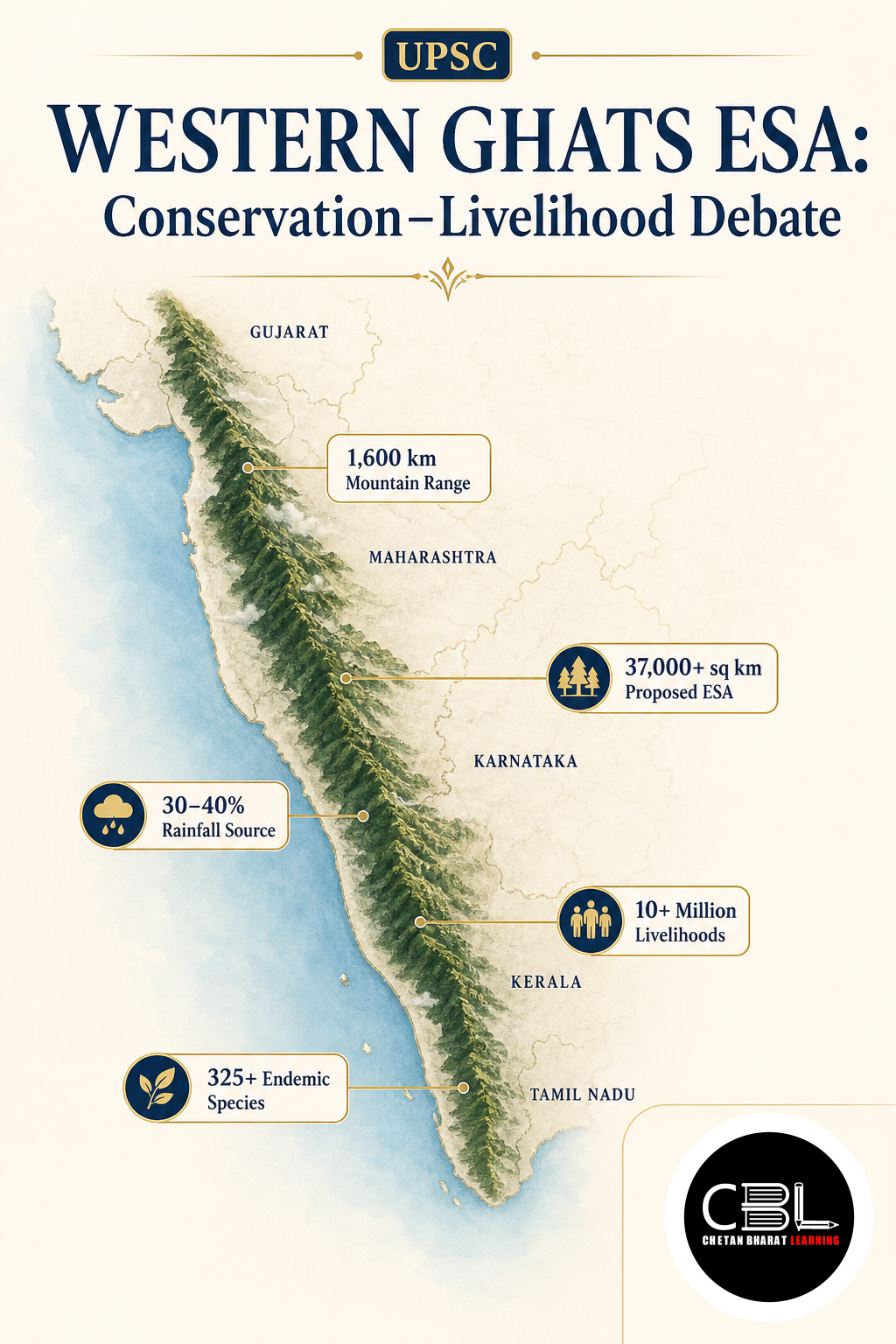
The Western Ghats extend for approximately 1,600 kilometres along India’s western side and influence the monsoon, rivers and peninsular climate. Their forests support high levels of endemism, meaning many species occur nowhere else. They also secure water, stabilise slopes, conserve soil and support agriculture downstream. Unregulated mining, quarrying, infrastructure expansion and forest fragmentation can weaken these ecosystem services and increase disaster vulnerability.
Why is Western Ghats ESA in News?
The Union Ministry of Environment, Forest and Climate Change issued the seventh draft Western Ghats ESA notification on 27 July 2026. It proposed bringing 56,825.7 square kilometres across six states under an ecologically sensitive framework. The Ministry invited stakeholder objections and suggestions before considering a final notification. The draft and submission period appeared on the Ministry’s official orders portal.
Karnataka’s legislature unanimously rejected the draft in its existing form on 22 September 2026 and sought time for a comprehensive ground survey. State representatives argued that satellite-based demarcation may not adequately separate natural forests from farmland, plantations and inhabited landscapes. They also raised concerns about infrastructure, agriculture and rural livelihoods. Conservationists maintain that continued delay exposes fragile slopes, wildlife habitats and river catchments to cumulative damage from high-impact development.
Key Features
The draft follows a landscape-based approach and targets activities carrying substantial environmental risks.
- Six-state coverage: The proposed area includes 449 square kilometres in Gujarat, 17,340 in Maharashtra, 1,461 in Goa, 20,668 in Karnataka, 9,993.7 in Kerala and 6,914 in Tamil Nadu.
- Mining restrictions: The draft proposes a complete ban on new mining, quarrying and sand mining, while existing mines would close within five years or upon lease expiry, whichever occurs earlier.
- Polluting industries: New red-category industries and expansion of existing red-category units would remain prohibited because they carry the highest pollution potential.
- Energy safeguards: Authorities would not permit new thermal power projects or expansion of existing thermal plants within the designated area.
- Large construction controls: The proposal restricts major building, township and area-development projects while allowing repairs, renovation and lawful extensions of existing residential houses.
The present proposal derives from recommendations of the High-Level Working Group led by K. Kasturirangan. The group used geospatial analysis to distinguish largely natural landscapes from cultural landscapes shaped by settlements, plantations and agriculture. It recommended ESA status for roughly 37 per cent of the Western Ghats. The Ministry’s Kasturirangan Committee report contains the state-wise and village-level basis of the recommended area.
This approach differed from the earlier Western Ghats Ecology Expert Panel led by Madhav Gadgil. The Gadgil panel favoured a more decentralised and graded system covering a wider landscape through different sensitivity levels. The Kasturirangan panel proposed a smaller ESA concentrated mainly on natural landscapes. The change sought to balance conservation with economic activity but did not eliminate disagreements over boundaries and governance.
Challenges
The central challenge involves reconciling ecological security with local rights, reliable mapping and development needs.
- Mapping disputes: Satellite imagery can identify broad land-cover patterns but may fail to capture small farms, recent changes, legal boundaries and mixed-use landscapes accurately.
- Livelihood concerns: Farmers, plantation workers and village residents fear that future regulatory interpretation could restrict land use, credit, housing or essential infrastructure.
- Intergovernmental differences: State governments seek locally adjusted boundaries, while the Union government must maintain ecological continuity across the entire mountain chain.
- Cumulative environmental damage: Project-by-project clearances may overlook the combined impact of mines, roads, resorts, dams and urban expansion on one connected ecosystem.
- Repeated delays: Successive draft notifications without final settlement create regulatory uncertainty and allow damaging land-use changes to continue in vulnerable areas.
Public debate sometimes treats ESA status as a blanket prohibition on human activity. The draft primarily focuses on mining, highly polluting industries, thermal power and large construction projects. Clear communication about permitted agriculture, plantations, homes and public services can reduce unnecessary fear. Authorities must also explain how rules affect land ownership and local development applications in practical terms.
Conservation measures can fail when communities view them as externally imposed restrictions. Gram sabhas, local governments, indigenous groups, farmers and scientists possess different forms of knowledge about landscapes. Their participation can identify wildlife corridors, landslide-prone slopes and livelihood zones more accurately. Aspirants can follow related environmental governance debates through the daily current affairs archive.
Way Forward
The government should combine high-resolution mapping with transparent ground verification before finalising boundaries. Survey teams can use satellite data, cadastral records, drone-based LiDAR and village consultations to distinguish forests, plantations, farms and settlements. Authorities should publish accessible maps and explain the evidence behind every inclusion or exclusion. A time-bound grievance mechanism can correct genuine mapping errors without reopening the entire conservation framework.
The final Western Ghats ESA framework should protect continuous ecosystems while recognising legitimate community needs. States must strengthen cumulative impact assessments, landslide-risk mapping and enforcement against illegal mining. Financial support can promote sustainable farming, ecological restoration, community tourism and climate-resilient infrastructure. Cooperative federalism, local participation and predictable regulations can convert the dispute into an effective model of people-centred conservation.
Prelims Practice Corner
Q1. The proposed ecologically sensitive area in the Western Ghats extends across how many states?
(a) Four (b) Five (c) Six (d) Seven
Answer: (c) The proposal covers Gujarat, Maharashtra, Goa, Karnataka, Kerala and Tamil Nadu.
Q2. The Kasturirangan Committee was primarily associated with:
(a) Coastal shipping reforms (b) Conservation of the Western Ghats (c) River-water adjudication (d) Agricultural price support
Answer: (b) The committee recommended measures and boundaries for protecting ecologically important Western Ghats landscapes.
Q3. Which activity does the 2026 draft propose to prohibit completely within the designated area?
(a) Traditional farming (b) Repairing existing houses (c) Mining and quarrying (d) Rainwater harvesting
Answer: (c) The proposal bans mining, quarrying and sand mining within the designated area.
Q4. Consider the following statements: 1. The Western Ghats influence the Indian monsoon. 2. They contain many endemic species. 3. They pass through Odisha. Which statements are correct?
(a) 1 only (b) 1 and 2 only (c) 2 and 3 only (d) 1, 2 and 3
Answer: (b) The Western Ghats influence rainfall and support endemic species, but they do not pass through Odisha.
Q5. Ecologically Sensitive Areas are generally notified under which legislation?
(a) Forest Rights Act, 2006 (b) Biological Diversity Act, 2002 (c) Environment Protection Act, 1986 (d) Wildlife Protection Act, 1972
Answer: (c) The Union government uses powers under the Environment Protection Act, 1986, to regulate activities in such areas.
Mains Practice Questions
Q1. Explain the ecological significance of regulating high-impact activities in the Western Ghats. (150 words, 10 marks)
Answer Structure
- Intro: Introduce the Western Ghats as a biodiversity hotspot and major watershed.
- Body: Cover endemism, monsoon influence, water security, slope stability and threats from mining and construction.
- Conclusion: Link targeted regulation with long-term ecological and economic security.
Q2. The Western Ghats conservation dispute tests both cooperative federalism and participatory environmental governance. Discuss. (250 words, 15 marks)
Answer Structure
- Intro: Frame the dispute as a balance between ecological protection and local development concerns.
- Body: Discuss Centre–state differences, mapping disputes, livelihoods, gram sabha participation and cumulative environmental risks.
- Conclusion: Recommend scientific ground verification, transparent consultation and time-bound finalisation.
FAQs on Western Ghats ESA
Does ESA status prohibit all human activity?
No. The proposal principally restricts high-impact activities such as mining, new thermal plants, red-category industries and large construction projects. Existing settlements and lawful livelihood activities do not automatically become prohibited.
Why has Karnataka opposed the latest draft?
The state has raised concerns about mapping accuracy, inhabited villages, agriculture and development requirements. It has sought a comprehensive ground survey before accepting the proposed boundaries.
How can the conservation dispute be resolved?
A credible Western Ghats ESA settlement requires scientific mapping, field verification and meaningful community consultation. Authorities must also provide clear rules, local livelihood support and consistent protection against ecologically damaging projects.
Related Current Affairs
Preparing for UPSC, PCS or HCS?
Talk to a mentor at Chetan Bharat Learning, Chandigarh. Free guidance on choosing the right exam and building a study plan.
Chat on WhatsAppCall 97793 53345UPSC / IAS / PCS coaching in Chandigarh · Trusted by aspirants across Punjab & Haryana
Leave a Reply
You must be logged in to post a comment.