
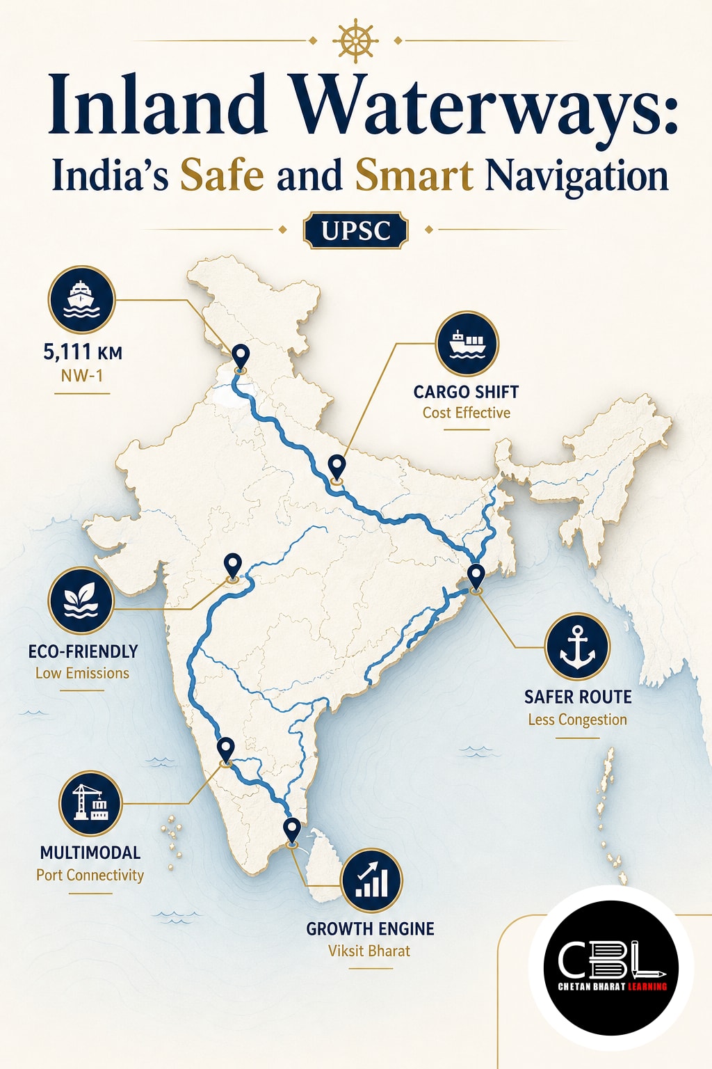

UPSC Mapping
- Prelims: National Waterways, IWAI and Navigation Technologies
- Mains: GS Paper III: Infrastructure and Logistics; GS Paper II: Government Interventions
Quick Facts
| Declared Network | 111 National Waterways |
|---|---|
| Total Length | 20,187 km |
| Operational Routes | 32, as reported in October 2026 |
| FY 2025–26 Cargo | 218 million metric tonnes |
What are Inland Waterways?
These are rivers, canals, backwaters and other inland channels that support vessel movement. Their transport potential depends on water depth, channel conditions, terminals and suitable vessels. National Waterway designation does not automatically establish year-round commercial navigability.
The Inland Waterways Authority of India undertakes navigation-related development and maintenance on National Waterways. Its responsibilities include surveys, fairway development, terminals and navigation support. These activities help connect river transport with the wider logistics network.
Why in News?
The October 2026 government backgrounder reports that waterborne cargo increased from 29 MMT in 2014–15 to 218 MMT in 2025–26. It also identifies 32 operational routes within the declared national network. Growing traffic increases the importance of dependable channels and timely navigation information.
River transport can reduce the cost and emissions of suitable freight movements. Its actual advantage depends on cargo type, loading efficiency and connecting transport. Comparisons with road or rail should assess the complete journey, including terminal handling and delivery.
Key Features of Navigation Development
- Hydrographic surveys: Measure river depth, bed features, flow conditions and hazards to support navigation planning.
- Channel maintenance: Fairway management and necessary dredging help maintain usable passages.
- Navigation aids: Buoys, lights and markers guide vessels and identify hazards.
- Digital services: Charts, depth information and vessel tracking support voyage preparation and coordination.
- Terminal integration: Connections with roads and railways link waterways with production centres and markets.
Hydrographic Surveys and Channel Depth
A river’s surface does not reveal the full condition of its navigable channel. Thalweg surveys identify and monitor the deepest channel along a stretch. Terminal and jetty surveys examine water depths and vessel approaches near facilities.
Least Available Depth, or LAD, is the minimum available channel depth over a specified stretch and period. Operators use it to plan routes and loading. Permissible vessel draft must also allow suitable under-keel clearance and account for operating conditions.
Dredging physically removes sediment from a water body. Surveys help identify where removal is necessary and guide maintenance priorities. Authorities should assess environmental effects rather than assume that deeper channels always justify unrestricted sediment removal.
Aids to Navigation
Aids to Navigation are external devices, systems or services that assist vessel movement. Buoys can mark channels or hazards, while lights improve visibility in appropriate conditions. A radar beacon, or Racon, responds to radar signals to help identify a navigational location.
The Directorate General of Lighthouses and Lightships manages general marine navigation aids along the coastline. IWAI maintains navigation infrastructure on National Waterways. These functions illustrate why coastal and inland responsibilities should be distinguished in examination answers.
Riverine Lighthouses and the Brahmaputra
The supplied article identifies lighthouse projects at Pandu, Bogibeel, Silghat and Biswanath Ghat in Assam. Their intended role is to supplement navigation support on the Brahmaputra. Announced or developing infrastructure should remain distinct from facilities already commissioned for use.
National Waterway-2 extends approximately 891 km between the Bangladesh border near Dhubri and Sadiya. IWAI maintains different depth requirements across its stretches. Its official route profile explains the waterway’s navigation and terminal infrastructure.
Digital Navigation and Traffic Information
Electronic Navigational Charts present hydrographic information digitally. The Portal for Asset and Navigation Information, or PANI, provides information about waterway assets and navigation resources. Their operational usefulness depends on accurate information and timely updates.
Naudarshika, the National River Traffic and Navigation System, supports vessel movement through navigation information, including available depth. River Information Services combine tracking, communications and environmental observations. AIS and VHF communication can help vessels coordinate with control centres.
Digital systems strengthen Inland Waterways by improving awareness of changing conditions. They complement physical markers, surveys and trained crews. Operators must still assess whether their vessel can safely navigate a particular channel.
Challenges
- Seasonal water levels: Changes in depth and current can restrict vessel loading and schedules.
- Shifting channels: Sedimentation and erosion create recurring survey and maintenance requirements.
- Connectivity gaps: Poor terminal access can offset savings from the river journey.
- Environmental pressures: Dredging, construction and vessel operations can affect habitats and river-dependent livelihoods.
- Commercial uncertainty: Freight operators need predictable services, sufficient cargo and suitable handling facilities.
- Information reliability: Outdated charts, failed sensors and communication gaps can weaken safety systems.
Round-the-clock navigation requires more than illuminated markers or lighthouses. Safe channels, trained personnel, emergency arrangements and dependable communications must operate together. Infrastructure availability should therefore be assessed as a complete service system.
Way Forward
Development should prioritise routes with credible freight demand and workable navigation conditions. Route-specific planning can align vessels, terminals and maintenance commitments. Reliable first-mile and last-mile links are essential to capture logistics benefits.
Authorities should publish timely depth information and maintain updated charts. Navigation aids need regular inspection and rapid repair arrangements. Crew training should cover digital interpretation, communication procedures and emergency response.
Environmental assessment should guide channel interventions and operating practices. Consultation with fishing communities and other river users can identify livelihood concerns. Monitoring should examine ecological effects alongside transport performance.
Inland Waterways can complement road and rail when services remain safe, predictable and commercially useful. Success should reflect total shipment costs, reliability and environmental outcomes. Consult the official navigation backgrounder and our infrastructure learning resources for further context.
Prelims Practice Corner
Q1. National Waterway-2 follows which river?
(a) Brahmaputra
(b) Godavari
(c) Narmada
(d) Tapi
Answer: (a) NW-2 covers the Brahmaputra between the Bangladesh border near Dhubri and Sadiya.
Q2. A thalweg survey primarily monitors:
(a) The deepest channel along a river stretch
(b) Atmospheric pressure over a port
(c) Annual industrial production
(d) Road traffic density
Answer: (a) Thalweg surveys identify and monitor the deepest channel and its changes.
Q3. Consider the following statements: 1. LAD influences vessel loading decisions. 2. Vessel draft can always equal LAD without additional clearance. Which is correct?
(a) 1 only
(b) 2 only
(c) Both 1 and 2
(d) Neither 1 nor 2
Answer: (a) Loading depends on available depth, while safe navigation also requires suitable under-keel clearance.
Q4. The abbreviation PANI refers to:
(a) Portal for Asset and Navigation Information
(b) Programme for Agricultural Nutrient Integration
(c) Port Authority for National Insurance
(d) Passenger Aviation Navigation Initiative
Answer: (a) PANI provides information concerning waterway assets and navigation resources.
Q5. Which pair is correctly matched?
(a) Racon — Radar-responsive beacon
(b) Dredging — Measurement of rainfall
(c) AIS — Agricultural irrigation subsidy
(d) Electronic Navigational Chart — Cargo insurance certificate
Answer: (a) A Racon responds to radar signals to assist identification of navigational locations.
Mains Practice Questions
Q1. Explain the complementary roles of hydrographic surveys, navigation aids and digital information in safe river transport. (150 words, 10 marks)
Answer Structure:
- Intro: Describe the changing nature of river channels.
- Body: Explain depth assessment, channel marking, chart updates and traffic coordination; identify maintenance and training requirements.
- Conclusion: Emphasise integration of reliable information with physical infrastructure.
Q2. Assess the potential and limitations of inland water transport in improving India’s logistics efficiency. (250 words, 15 marks)
Answer Structure:
- Intro: Present river transport as part of a multimodal freight network.
- Body: Discuss suitable cargo, potential cost advantages and connectivity; assess seasonal depth, terminal access, ecological impacts and service reliability.
- Conclusion: Recommend demand-based investment with environmental safeguards and measurable logistics outcomes.
Frequently Asked Questions
Does National Waterway status guarantee year-round navigation?
No. Operating conditions depend on available depth, channel stability, infrastructure and vessel characteristics. Declaration and commercial operation are distinct.
How does dredging differ from surveying?
Surveying measures depths, bed features and related conditions. Dredging removes sediment to maintain or improve a navigational channel.
Can digital navigation replace physical maintenance?
No. Digital systems improve situational awareness but cannot remove shoals or repair navigation aids. Safe services require maintenance, current information and trained crews together.
Related Current Affairs
Preparing for UPSC, PCS or HCS?
Talk to a mentor at Chetan Bharat Learning, Chandigarh. Free guidance on choosing the right exam and building a study plan.
Chat on WhatsAppCall 97793 53345UPSC / IAS / PCS coaching in Chandigarh · Trusted by aspirants across Punjab & Haryana
Leave a Reply
You must be logged in to post a comment.