

UPSC Mapping
Important for:
- Prelims: International Relations
- Mains: GS Paper 2 (International Relations)
Quick Facts
| Resolution Name | Correct the Map |
|---|---|
| Key Date | September 4 |
| Disputed Regions | Arunachal, Aksai Chin, Kalapani |
What is the UN Endorsed Map?
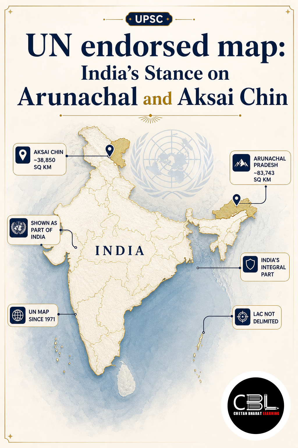
The UN endorsed map emerged from recent global consultations linked to the concept of cognitive justice in cartography. African nations initially spearheaded this movement, seeking an Equal Earth projection to represent their continent more accurately. This valid initiative subsequently led to broader United Nations consultations on global map representations. However, the resulting document introduces ambiguous claim lines around highly sensitive border regions. It places Arunachal Pradesh and Aksai Chin between Indian and Chinese claim lines without clear demarcation.
This cartographic ambiguity directly contradicts established historical and legal facts. India has consistently maintained that Arunachal Pradesh constitutes an integral part of its sovereign territory. Similarly, New Delhi treats Aksai Chin as an inseparable part of Ladakh despite current Chinese control. The map fails to reflect these non-negotiable realities of Indian geography. Such representations risk misleading international audiences about the true status of these regions.
Why is the UN Endorsed Map in News?
The UN endorsed map gained prominence after its formal endorsement during the India-backed Correct the Map resolution. The document shows Jammu and Kashmir with a dotted line indicating the Line of Control. A specific explanatory note clarifies this dotted line represents the LoC agreed upon by India and Pakistan. You can verify India’s official diplomatic stance through the MEA official statements on border integrity.
Crucially, no comparable explanatory note exists for the claim lines around Arunachal Pradesh and Aksai Chin. This selective omission creates a false equivalence between established agreements and unilateral territorial claims. Furthermore, the map reflects India’s administrative control over the Kalapani-Lipulekh-Limpiyadhura region. This specific detail counters Nepal’s competing claims over the same strategic territory. The map remains non-binding, yet multilateral institutions across the world may still use it as a reference.
Key Features
- Cognitive Justice Focus: The map originated from legitimate efforts to ensure fair and accurate global geographic representation for developing nations.
- Ambiguous Claim Lines: It controversially places Arunachal Pradesh and Aksai Chin between unspecified Indian and Chinese boundaries.
- LoC Clarification: It explicitly notes the dotted line in Jammu and Kashmir as the mutually agreed India-Pakistan Line of Control.
- Kalapani Representation: The document reflects India’s administrative control over the Kalapani-Lipulekh-Limpiyadhura region, directly countering Nepal’s claims.
- Non-binding Nature: The document serves merely as a reference guide rather than a legally binding international treaty or border agreement.
Challenges
- Normalization of Ambiguity: Repeated use in multilateral institutions might gradually normalize disputed territorial claims among global audiences.
- Diplomatic Friction: Ambiguous lines fuel unnecessary tensions with neighboring countries like China and complicate bilateral dialogues.
- Lack of Explanatory Notes: The map fails to provide comparable explanatory notes for the Arunachal and Aksai Chin regions, creating a misleading narrative.
- Cartographic Precedent: Other nations might adopt this flawed representation in their own official publications and educational materials.
- Strategic Vulnerability: Persistent misrepresentation can complicate ongoing border management and confidence-building measures on the ground.
Addressing these bottlenecks requires proactive diplomatic engagement and consistent correction of public records. Aspirants should review our UPSC prelims strategy guide to understand how such border disputes are frequently framed in examinations.
Way Forward
To counter the implications of the UN endorsed map, India must aggressively pursue diplomatic corrections at all levels. New Delhi should actively lobby multilateral institutions to adopt accurate and unambiguous cartographic representations. Bilateral engagements must firmly reiterate India’s non-negotiable stance on Arunachal Pradesh and Aksai Chin. Consistent diplomatic pushback prevents the gradual acceptance of flawed geographical narratives.
Furthermore, India should champion the Correct the Map resolution globally to set a positive and accurate precedent. The Ministry of External Affairs must continuously monitor and rectify such cartographic anomalies in real-time. This comprehensive strategy will ultimately safeguard India’s territorial integrity and historical truth on the world stage.
Prelims Practice Corner
Q1. Consider the following statements regarding the UN endorsed map:
- 1. It places Arunachal Pradesh and Aksai Chin between unspecified claim lines.
- 2. It is a legally binding international treaty regarding border demarcations.
Which of the statements given above is/are correct?
- (a) 1 only
- (b) 2 only
- (c) Both 1 and 2
- (d) Neither 1 nor 2
Answer
(a) The map is non-binding and serves only as a reference guide, not a legally binding treaty.
Q2. The map emerged from consultations linked to which concept in cartography?
- (a) Cognitive justice
- (b) Geopolitical realism
- (c) Cartographic aggression
- (d) Spatial determinism
Answer
(a) The map emerged from consultations linked to the idea of cognitive justice in cartography.
Q3. How does the UN endorsed map represent the Kalapani region?
- (a) As an independent territory
- (b) Reflecting India’s control, countering Nepal’s claims
- (c) As part of China
- (d) As a disputed zone with no administrative control
Answer
(b) The map reflects India’s control over the Kalapani-Lipulekh-Limpiyadhura region, which Nepal also claims.
Q4. What explanatory note does the map provide regarding Jammu and Kashmir?
- (a) It marks the International Border clearly
- (b) It shows a dotted line representing the LoC agreed by India and Pakistan
- (c) It declares the region fully independent
- (d) It provides no notes on Jammu and Kashmir
Answer
(b) A note explains that the dotted line broadly represents the Line of Control agreed upon by India and Pakistan.
Q5. Which resolution backed the endorsement of this new world map at the UN?
- (a) Correct the Map
- (b) Equal Earth Initiative
- (c) Border Clarity Resolution
- (d) Cognitive Mapping Accord
Answer
(a) The map was endorsed during the India-backed Correct the Map resolution.
Mains Practice Questions
Q1. Discuss the implications of the UN endorsed map on India’s territorial integrity and diplomatic relations. (150 words, 10 marks)
Intro: Briefly introduce the UN endorsed map and its ambiguous representation of Arunachal Pradesh and Aksai Chin.
Body: Implications include normalization of disputed claims, diplomatic friction with China and Nepal, misleading global narrative; India’s stance (non-negotiable sovereignty, historical facts, corrective diplomacy).
Conclusion: Emphasize the need for proactive multilateral engagement to ensure accurate cartographic representation.
Q2. ‘Cartography is not merely a scientific exercise but a potent tool of geopolitical assertion.’ Critically examine in the context of recent UN map endorsements. (250 words, 15 marks)
Intro: Define cartography as a reflection of political power and historical narratives, not just geography.
Body: Geopolitical assertion (shaping global perception, legitimizing claims, cognitive justice vs. strategic ambiguity); Case study (UN map’s treatment of Arunachal, Aksai Chin, Kalapani, and LoC); Challenges (non-binding yet influential, risk of precedent).
Conclusion: Summarize that nations must actively participate in global cartographic forums to safeguard their sovereign narratives.
FAQs on UN Endorsed Map
What is the UN endorsed map?
It is a world map endorsed at the UN during the Correct the Map resolution, which controversially places Arunachal Pradesh and Aksai Chin between unspecified claim lines.
Is the UN endorsed map legally binding?
No, the map is non-binding. However, it may still be used as a reference by multilateral institutions across the world, making diplomatic correction essential.
How does the map represent the Kalapani region?
The map reflects India’s administrative control over the Kalapani-Lipulekh-Limpiyadhura region, which directly counters competing territorial claims by Nepal.
Related Current Affairs
Preparing for UPSC, PCS or HCS?
Talk to a mentor at Chetan Bharat Learning, Chandigarh. Free guidance on choosing the right exam and building a study plan.
Chat on WhatsAppCall 97793 53345UPSC / IAS / PCS coaching in Chandigarh · Trusted by aspirants across Punjab & Haryana
Leave a Reply
You must be logged in to post a comment.