
UPSC Syllabus Mapping
| GS Paper | GS-I & GS-III |
|---|---|
| Subject | Geography, Disaster Management and Environment |
| Syllabus Pointers | Prep with our comprehensive UPSC Current Affairs Hub analysis guidelines. |
Article
Recent updates regarding Landslide Early Warning emphasise the urgent need for scientific early warning systems, particularly in the Western Ghats and other landslide-prone regions. Advances in rainfall forecasting, remote sensing and sensor-based monitoring can provide timely alerts, minimise casualties and strengthen disaster preparedness.
Key Dimensions of Landslide Early Warning
Landslides are the downward movement of rock, soil or debris under the influence of gravity. They are a form of mass wasting and occur due to a combination of natural factors such as intense rainfall, earthquakes, weathering and steep slopes, along with human activities including road construction, mining, deforestation and unplanned urbanisation.
According to the National Disaster Management Authority (NDMA), around 13% of India’s land area is prone to landslides. The highest vulnerability is observed in the Himalayan region and the Western Ghats.
Why Are the Western Ghats Vulnerable?
The Western Ghats experience high monsoon rainfall, steep terrain, fragile geological formations and expanding infrastructure development. Deforestation and changes in land use further reduce slope stability, increasing the likelihood of landslides during extreme rainfall events.
How Does a Landslide Early Warning System Work?
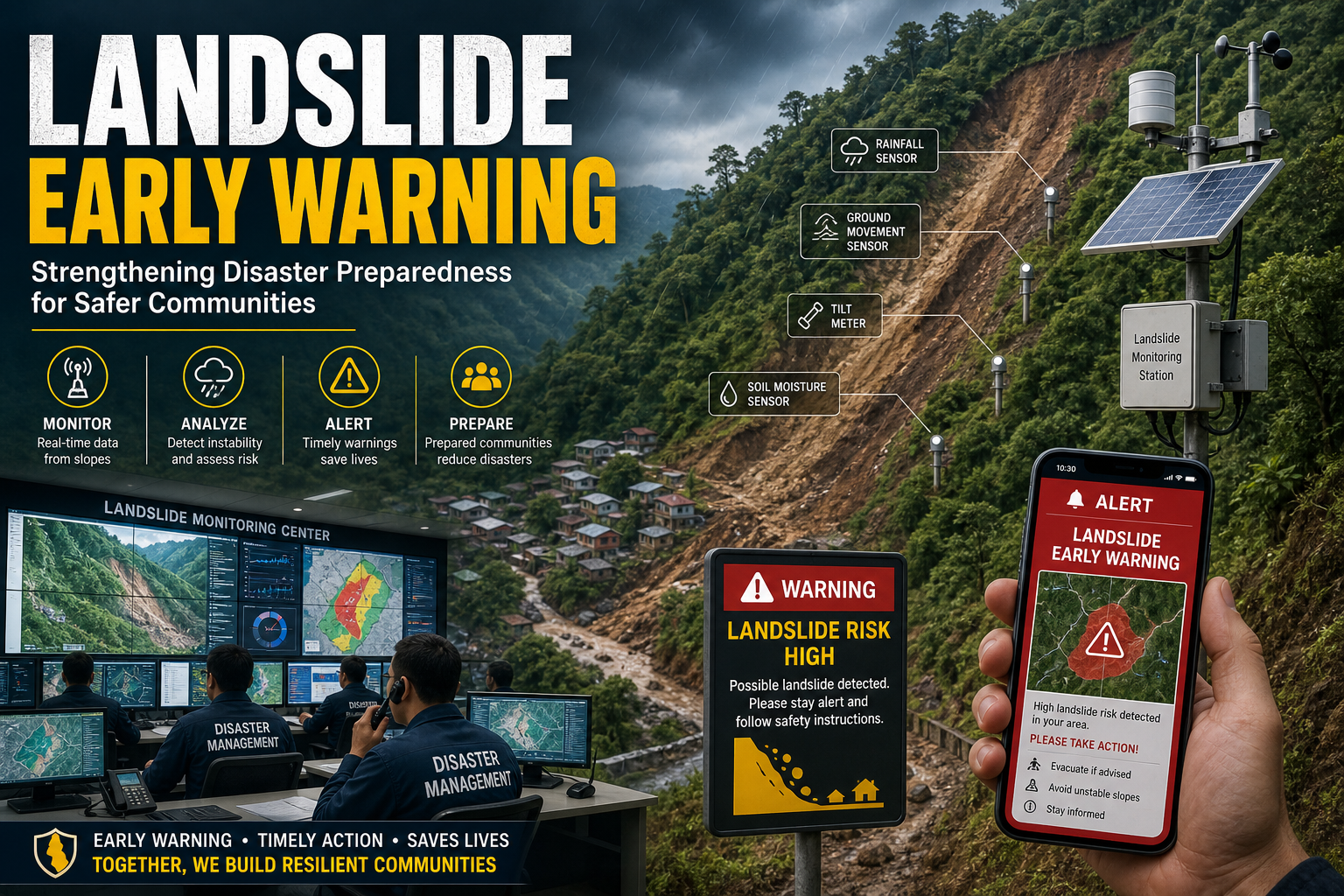
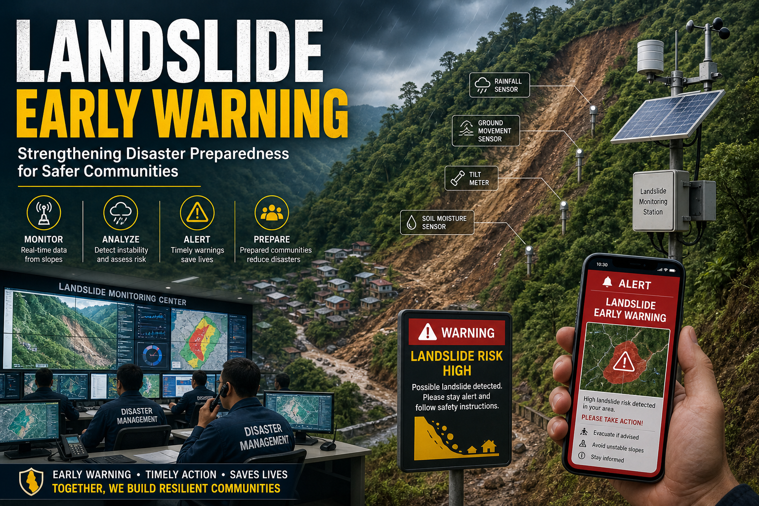
A Landslide Early Warning System (EWS) detects conditions that increase landslide risk and issues alerts before slope failure occurs. Although it cannot prevent landslides, it provides valuable time for evacuation and emergency response.
- Sensor-based monitoring: Instruments measure rainfall, soil moisture, ground movement, pore-water pressure and slope deformation. Alerts are generated when observed values exceed predefined thresholds.
- Probabilistic forecasting: Combines satellite observations, rainfall forecasts, historical landslide records, terrain characteristics, rock stability and land-use information to estimate landslide probability over wider regions. Remote sensing, GIS, AI and machine learning further improve hazard mapping and forecasting accuracy.
For additional background on landslides, refer to global developmental tracking frameworks.
Way Forward
India should expand high-resolution rainfall monitoring, install dense sensor networks in vulnerable slopes, strengthen GIS-based hazard mapping and improve coordination between IMD, NDMA, State Disaster Management Authorities and local governments. Community awareness, evacuation planning, sustainable land-use practices and resilient infrastructure should complement technological solutions to reduce landslide risk.
Prelims Practice Corner
Q1. A landslide is best defined as:
- (a) Upward movement of rocks
- (b) Downward movement of rock, soil or debris under gravity
- (c) Volcanic eruption
- (d) River erosion only
Answer: (b)
Landslides are a form of mass wasting in which rock, soil or debris moves downslope under the influence of gravity.
Q2. Which technology is commonly used in modern landslide early warning systems?
- (a) GIS and remote sensing
- (b) Nuclear reactors
- (c) Thermal power plants
- (d) Marine navigation systems
Answer: (a)
GIS, remote sensing, satellite data and sensor networks are widely used for landslide monitoring and early warning.
Mains Practice Question
“Scientific landslide early warning systems are essential for reducing disaster risk in India’s mountainous regions. Discuss the role of technology, governance and community preparedness in strengthening landslide resilience.” (150 Words, 10 Marks)
FAQs
Why are early warning systems important for landslides? They provide advance alerts based on measurable warning signs, allowing timely evacuation, reducing casualties and improving disaster response.
Related Current Affairs
Preparing for UPSC, PCS or HCS?
Talk to a mentor at Chetan Bharat Learning, Chandigarh. Free guidance on choosing the right exam and building a study plan.
Chat on WhatsAppCall 97793 53345UPSC / IAS / PCS coaching in Chandigarh · Trusted by aspirants across Punjab & Haryana
Leave a Reply
You must be logged in to post a comment.