

UPSC Mapping
- Prelims: Environment & Disaster Management
- Mains: GS Paper 3 (Environment & Disaster Management)
Quick Facts
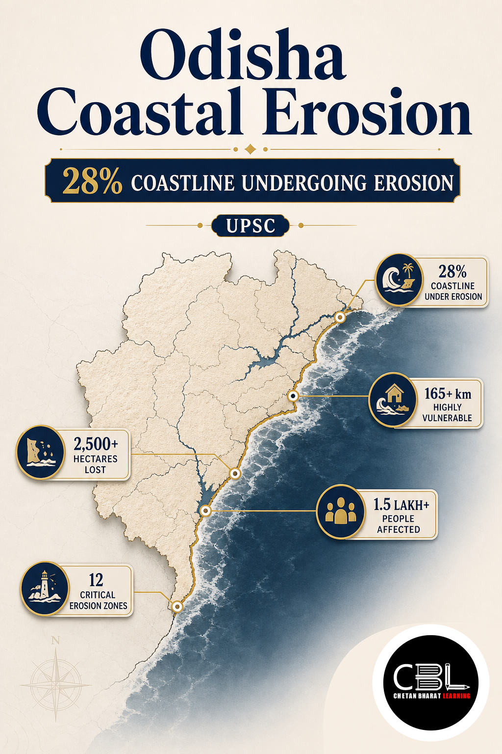
| Erosion-affected | 28.3% of coastline |
|---|---|
| Most Erosion-Prone District | Jagatsinghpur (47.6%) |
| Villages Submerged | 16 (Kendrapara) |
What is Odisha Coastal Erosion?
Odisha Coastal Erosion refers to the gradual loss of land along the state’s 564-km coastline due to natural forces and human activities. According to a National Centre for Coastal Research (NCCR) study (1990–2022), 28.3% of the coast is eroding, 17.6% remains stable, and 54.1% is accreting.
The most vulnerable stretches include Jagatsinghpur (47.6% erosion), Ganjam (45.7%), and Kendrapara (45%). Factors driving erosion include waves, tides, storms, sea-level rise, port construction, unplanned infrastructure, and sand mining. Sixteen villages in Kendrapara have already been submerged.
Why is Odisha Coastal Erosion in News?
The issue gained attention after a Rajya Sabha reply by the Union Minister, citing the NCCR study. In response to an Odisha MP’s query, the government highlighted the resettlement policy—the country’s first climate-oriented policy—geotextile tube embankments, and sea wall-cum-serving roads as mitigation measures.
Key Features of Odisha Coastal Erosion
- High Vulnerability: Six coastal districts (Ganjam, Puri, Jagatsinghpur, Kendrapara, Bhadrak, Balasore) are affected.
- Cyclone Prone: Frequent storm surges exacerbate erosion.
- Sediment Dynamics: Rivers like the Mahanadi supply sediment, but dams and coastal structures disrupt the budget.
- Longshore Drift: Hard structures interrupt sediment flow, causing erosion elsewhere.
- Ecosystem Impact: Chilika Lake and other coastal ecosystems suffer from saltwater intrusion and shoreline alteration.
Challenges in Managing Odisha Coastal Erosion
- Sea-Level Rise: Climate change accelerates erosion and saltwater intrusion.
- Hard Structures: Sea walls and jetties transfer erosion downstream.
- Sand Mining: Illegal extraction reduces sediment supply.
- Development Pressure: Unplanned coastal projects worsen vulnerability.
- Livelihood Loss: Fishing communities and farmers face displacement and income loss.
Way Forward
- Combine hard engineering (geotextile tubes, sea walls) with nature-based solutions (mangrove restoration, beach nourishment).
- Promote managed retreat—voluntary relocation from high-risk zones.
- Strictly enforce Coastal Regulation Zone (CRZ) norms and regulate sand mining.
- Implement climate-resilient planning and early warning systems.
- Adopt international best practices (e.g., UNEP guidelines) for coastal management.
Prelims Practice Corner
Q1. What percentage of Odisha’s coastline is undergoing erosion?
Options: (a) 17.6% (b) 28.3% (c) 54.1% (d) 45.7%
Show answer
Answer: (b) 28.3%
Q2. Which district is the most erosion-prone in Odisha?
Options: (a) Ganjam (b) Jagatsinghpur (c) Kendrapara (d) Puri
Show answer
Answer: (b) Jagatsinghpur (47.6%)
Q3. What is a geotextile tube?
Options: (a) A type of fishing net (b) A large synthetic fabric tube filled with sand (c) A pipe for drainage (d) A tube for transporting water
Show answer
Answer: (b) A synthetic container filled with sand to absorb wave impact.
Q4. Which lagoon in Odisha is affected by coastal changes?
Options: (a) Sambhar Lake (b) Chilika Lake (c) Vembanad Lake (d) Pulicat Lake
Show answer
Answer: (b) Chilika Lake
Q5. What is managed retreat as a coastal adaptation strategy?
Options: (a) Building more sea walls (b) Relocating communities from high-risk areas (c) Dredging rivers (d) Planting more trees
Show answer
Answer: (b) Planned relocation from vulnerable coastal zones.
Mains Practice Questions
Q1. Discuss the causes and impacts of coastal erosion in Odisha, and evaluate the measures being taken to address it. (250 words, 15 marks)
Answer Structure:
- Intro: NCCR study and scale of erosion.
- Body: Natural factors (waves, tides, cyclones, sea-level rise); anthropogenic factors (ports, sand mining, infrastructure); impacts; mitigation (geotextile tubes, sea walls, resettlement).
- Conclusion: Hybrid hard and nature-based solutions.
Q2. What is the Coastal Regulation Zone (CRZ) framework, and how does it help in managing coastal erosion? (150 words, 10 marks)
Answer Structure:
- Intro: Definition of CRZ as a coastal development regulatory framework.
- Body: Different CRZ zones; restrictions on construction, sand mining, industry; protection of ecosystems; erosion reduction.
- Conclusion: Importance of effective enforcement for coastal resilience.
FAQs on Odisha Coastal Erosion
What is causing coastal erosion in Odisha?
Natural factors (waves, tides, cyclones, sea-level rise) and human activities (port construction, sand mining, unplanned development).
How many villages have been submerged in Kendrapara?
Sixteen villages have been submerged due to sea-level rise and coastal erosion.
What is a sea wall-cum-serving road?
A dual-purpose structure: the outer tier defends against waves, and the inner tier serves as a local transport road.
Related Current Affairs
Preparing for UPSC, PCS or HCS?
Talk to a mentor at Chetan Bharat Learning, Chandigarh. Free guidance on choosing the right exam and building a study plan.
Chat on WhatsAppCall 97793 53345UPSC / IAS / PCS coaching in Chandigarh · Trusted by aspirants across Punjab & Haryana
Leave a Reply
You must be logged in to post a comment.