
UPSC Mapping
Prelims
- Hindu Kush-Himalaya, Peak Water and GLOFs
Mains
- GS Papers I and III — Geography, Environment and Disasters
Article
What are Himalayan Glaciers?
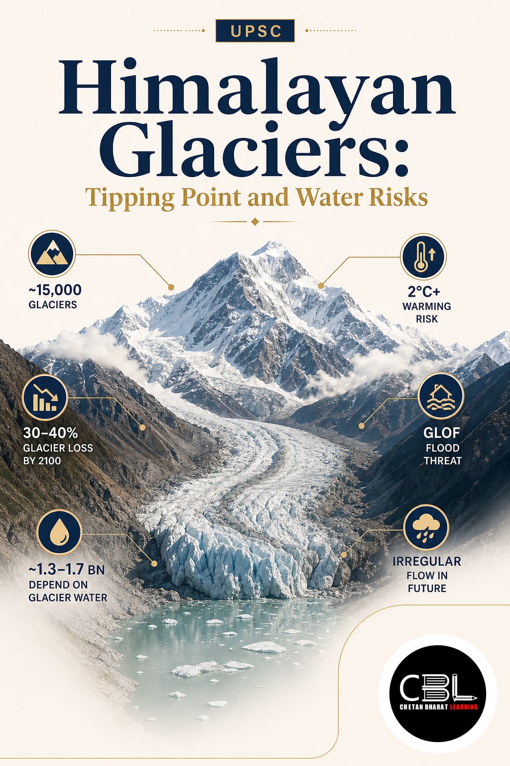
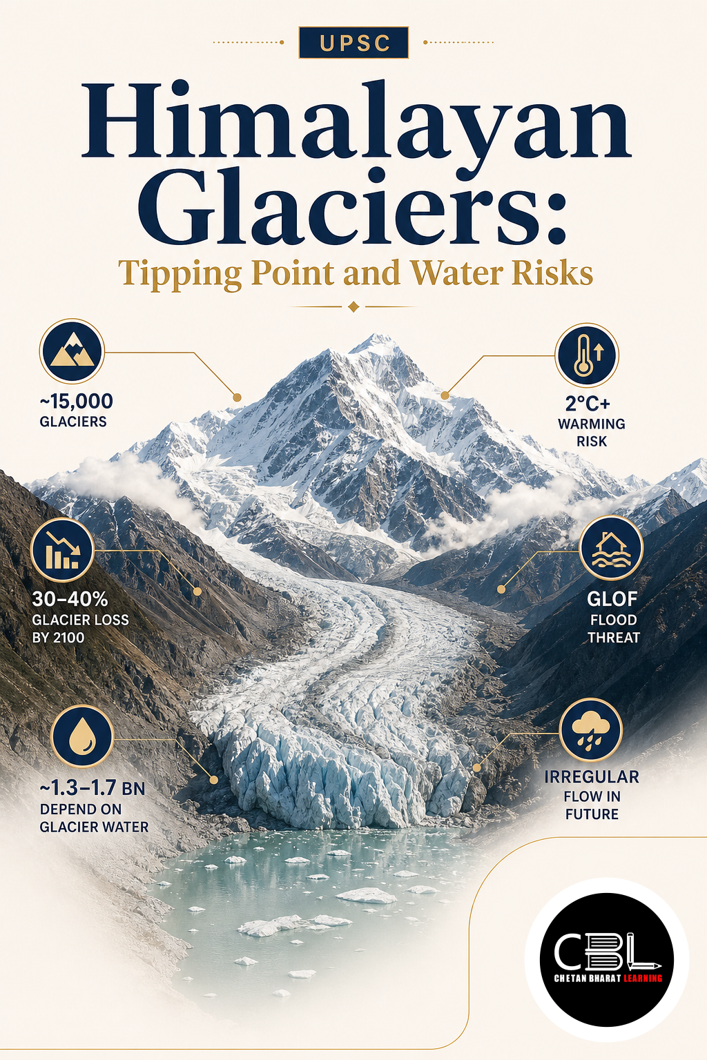
Himalayan Glaciers are persistent bodies of ice formed from accumulated and compressed snowfall in high mountain areas. They store water during colder periods and release meltwater into rivers during warmer months. This seasonal function supports agriculture, hydropower, ecosystems and communities across South and Central Asia.
These glaciers form part of the wider Hindu Kush-Himalaya, which extends across Afghanistan, Bangladesh, Bhutan, China, India, Myanmar, Nepal and Pakistan. Its snowfields and ice reserves influence major river systems, including the Indus, Ganga and Brahmaputra. Their condition therefore affects both mountain settlements and densely populated downstream plains.
Quick Facts
| Mountain System | Hindu Kush-Himalaya |
|---|---|
| Countries Covered | Eight countries |
| Water Threshold | Peak water by mid-century |
| Major Hazard | Glacial lake outburst floods |
| High-Risk Indian Lakes | Nearly 200 identified |
| Very High Risk | 56 glacial lakes |
Why are Himalayan Glaciers in News?
Himalayan Glaciers entered the news after research warned that accelerating mass loss could push the region towards a climate tipping point. A tipping point is a critical threshold beyond which a system experiences substantial and potentially irreversible change. Rising temperatures and changing snowfall patterns are weakening long-term glacier stability.
The assessment warned that several glacier-fed basins could approach peak water around the middle of the century. River discharge may rise temporarily as melting accelerates but decline after glacier reserves shrink substantially. Regional research coordinated through institutions such as the International Centre for Integrated Mountain Development highlights the need for transboundary monitoring and adaptation.
Key Features
- Accelerating mass loss: Many glaciers now lose ice faster than during earlier decades because rising temperatures lengthen melting seasons and increasingly convert snowfall into rainfall.
- Peak-water transition: Meltwater discharge initially increases but reaches a maximum before declining as the shrinking glacier can no longer supply the same volume.
- Expanding glacial lakes: Retreating ice can leave depressions filled with meltwater behind unstable moraine, rock or ice barriers that may fail suddenly.
- Compound mountain hazards: Glacier loss, thawing permafrost, intense rainfall, landslides and earthquakes can interact, producing cascading floods that exceed historical risk assessments.
- Transboundary consequences: Changes in snow and ice influence shared rivers, linking water, agriculture, energy and disaster risks across several national borders.
Challenges
- Limited ground monitoring: Only a small fraction of the thousands of glaciers across the region receive continuous field observations, leaving major gaps in mass-balance and hydrological data.
- Uncertain local projections: Glaciers respond differently to elevation, slope, debris cover, temperature and snowfall, making basin-level water forecasts more difficult than broad regional assessments.
- Weak warning coverage: Remote valleys may lack sensors, communication networks, evacuation routes and trained response teams capable of acting before a sudden outburst reaches settlements.
- Growing exposure: Hydropower plants, roads, tourism facilities and settlements increasingly occupy narrow valleys where flash floods, landslides and debris flows can cause concentrated damage.
- Fragmented governance: Climate, water, energy, infrastructure and disaster agencies often use separate datasets and planning processes, limiting integrated risk management.
Way Forward
Protecting communities affected by Himalayan Glaciers requires expanded ground stations, satellite observations and repeated mapping of glacial lakes. Authorities should combine scientific risk assessments with automatic water-level sensors, weather information and downstream warning systems. Hazard information must guide the location and design of roads, dams, bridges and settlements.
States should prepare evacuation routes, community drills and emergency communication systems for vulnerable valleys. Carefully engineered drainage may reduce danger at selected lakes after detailed assessment. National guidance from the National Disaster Management Authority should support basin-level planning, regional data sharing and stronger climate adaptation alongside rapid emission reduction.
Prelims Practice Corner
Q1. In climate science, a tipping point refers to:
(a) A regular seasonal variation (b) A critical threshold producing major and potentially irreversible change (c) The daily freezing of a river (d) A temporary weather forecast
Answer
(b) Crossing a tipping point can shift a system into a substantially different and difficult-to-reverse state.
Q2. What does peak water mean in a glacier-fed river basin?
(a) The highest tidal level (b) Maximum meltwater flow before long-term decline (c) The annual monsoon maximum (d) The total groundwater reserve
Answer
(b) Meltwater rises during accelerated retreat but later declines as the remaining ice reserve becomes smaller.
Q3. A glacial lake outburst flood most commonly occurs when:
(a) A lake’s natural barrier fails suddenly (b) Ocean tides enter a mountain valley (c) Groundwater extraction stops (d) A river freezes completely
Answer
(a) Failure of a moraine, ice or rock barrier can release stored lake water rapidly.
Q4. Which of the following countries is not part of the Hindu Kush-Himalaya region?
(a) Bhutan (b) Nepal (c) Myanmar (d) Sri Lanka
Answer
(d) Sri Lanka does not form part of the Hindu Kush-Himalaya mountain system.
Q5. Which combination is most suitable for monitoring glacier-related hazards?
(a) Satellite imagery, field observations and automatic sensors (b) Census surveys alone (c) Ocean buoys alone (d) Agricultural price data alone
Answer
(a) Remote sensing and ground measurements together provide broader and more reliable hazard information.
Mains Practice Questions
Q1. Explain how accelerated glacier retreat can produce both short-term flood risks and long-term water insecurity. (15 marks)
Answer Structure
- Intro: Describe glaciers as natural stores regulating seasonal river flows.
- Body: Discuss accelerated melting, peak water, glacial lakes, GLOFs, declining ice reserves and effects on food and energy security.
- Conclusion: Link scientific monitoring with adaptation, preparedness and global emission reduction.
Q2. Assess India’s preparedness for managing glacial lake outburst flood risks in the Himalayan region. (15 marks)
Answer Structure
- Intro: Define GLOFs and explain their growing relevance under climate change.
- Body: Examine lake inventories, monitoring gaps, warning systems, infrastructure exposure, community capacity and interstate coordination.
- Conclusion: Recommend integrated basin management combining technology, local knowledge and risk-sensitive development.
FAQs on Himalayan Glaciers
Why are Himalayan Glaciers important for India?
They store snow and ice that contribute to major river systems and seasonal water availability. Their condition affects agriculture, hydropower, ecosystems and communities across mountain and downstream regions.
Does glacier melting always increase river flows?
No. Accelerated melting can initially increase flows, but discharge eventually declines after the glacier loses substantial ice. Seasonal effects also vary between river basins.
How can India reduce glacial lake flood risks?
India needs repeated lake mapping, automatic sensors, dependable warnings and evacuation planning. Infrastructure development should also incorporate updated mountain-hazard assessments.
Related Current Affairs
Preparing for UPSC, PCS or HCS?
Talk to a mentor at Chetan Bharat Learning, Chandigarh. Free guidance on choosing the right exam and building a study plan.
Chat on WhatsAppCall 97793 53345UPSC / IAS / PCS coaching in Chandigarh · Trusted by aspirants across Punjab & Haryana
Leave a Reply
You must be logged in to post a comment.