
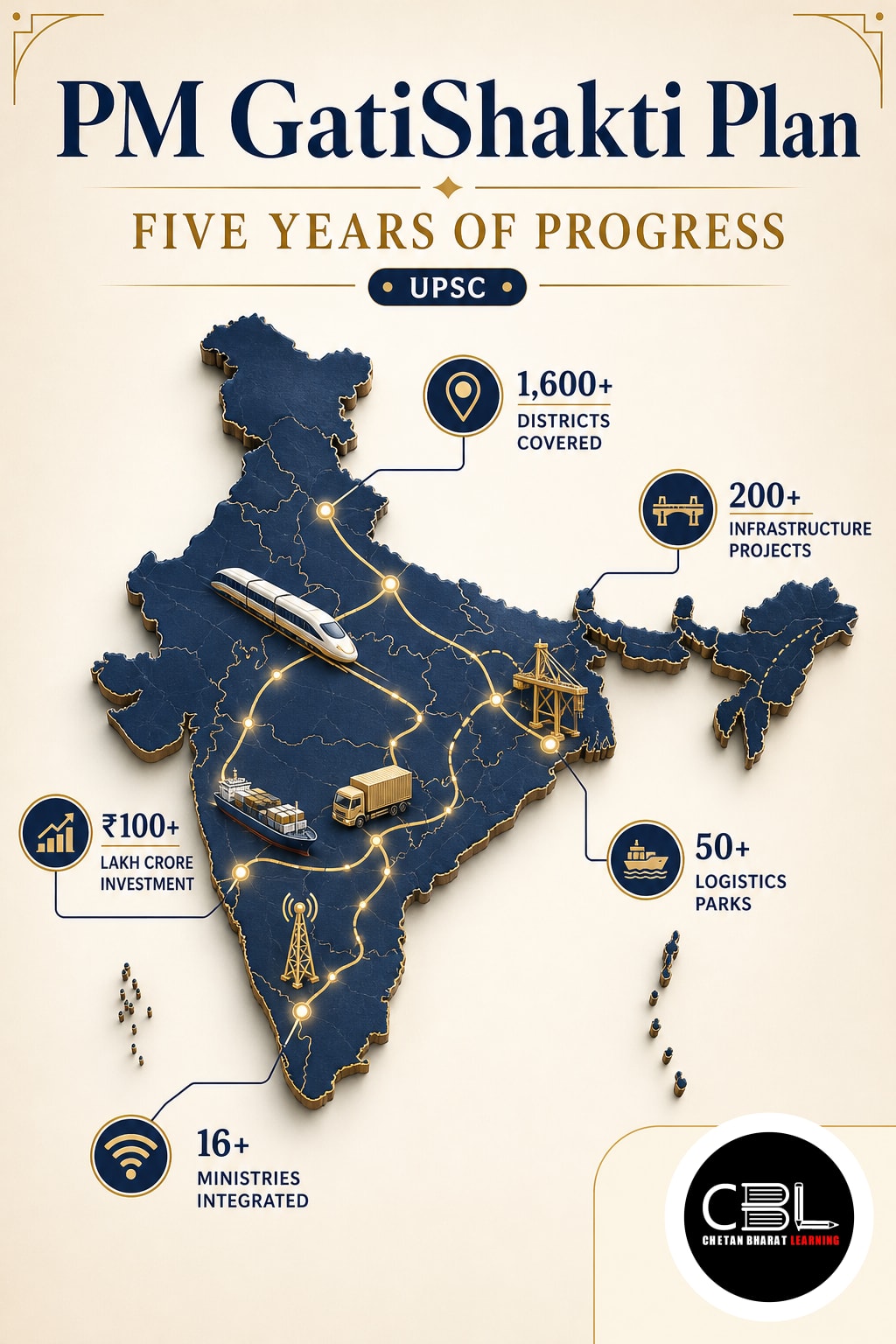

PM GatiShakti Plan completed five years on 13 October 2026, marking significant progress in India’s integrated infrastructure planning. Launched in 2021, the National Master Plan uses geospatial technology and interministerial coordination to improve multimodal connectivity. The milestone coincided with the Union Cabinet’s approval of the Integrated Transport and Logistics Authority (ITLA), which will strengthen long-term transport planning and project appraisal. Explore related developments in the daily current affairs archive.
What is the PM GatiShakti Plan?
The PM GatiShakti National Master Plan is a GIS-based digital framework for integrated infrastructure planning. It combines satellite imagery, geospatial information and departmental databases to support coordinated infrastructure development.
The initiative replaces isolated departmental planning with a whole-of-government approach. Ministries and states can examine existing networks, identify connectivity gaps and coordinate new infrastructure investments.
Its digital platform was developed by the Bhaskaracharya National Institute for Space Applications and Geo-informatics (BISAG-N). The initiative facilitates coordinated planning rather than operating as a separate infrastructure construction fund.
Why in News?
India marked the fifth anniversary of PM GatiShakti on 13 October 2026. The government highlighted its expansion from infrastructure mapping into integrated planning for economic and social development.
The Network Planning Group evaluated 421 infrastructure projects worth approximately ₹20.23 lakh crore by October 2026. The platform now connects 58 Central Ministries and Departments with all 36 States and Union Territories.
The Union Cabinet also approved ITLA on 6 October 2026. This proposed institutional mechanism will complement existing infrastructure planning through research, technical appraisal, monitoring and impact assessment.
These developments were highlighted in the PIB fifth-anniversary announcement.
Key Features of PM GatiShakti
- Seven infrastructure engines: Integrates roads, railways, ports, waterways, airports, mass transport and logistics infrastructure.
- Integrated GIS platform: Combines physical infrastructure, economic zones, environmental features and geographical information.
- Interministerial coordination: Enables multiple government departments to identify overlapping projects and plan investments jointly.
- Digital infrastructure mapping: The October 2026 government backgrounder reports more than 23,493 geospatial data layers.
- Digital planning tools: The platform supports more than 65 software modules or tools and over 100 applications.
- Public geospatial access: The PM GatiShakti Public platform provides access to selected approved datasets for planning and analysis.
- District-level expansion: Planning capabilities increasingly cover local roads, healthcare, educational infrastructure and other public services.
Six Principles of PM GatiShakti
| Principle | Objective |
|---|---|
| Integrated Development | Coordinate infrastructure planning across departments |
| Multimodal Infrastructure | Integrate different transportation networks |
| Last-Mile Connectivity | Connect economic and social centres with transport networks |
| Expedited Land Acquisition | Identify land requirements and reduce avoidable delays |
| Expedited Clearances | Improve coordination and timely regulatory processing |
| Reduced Ecological Impact | Consider environmental constraints during infrastructure planning |
Three-Tier Institutional Framework
- Empowered Group of Secretaries: Chaired by the Cabinet Secretary, it provides policy direction and oversees implementation.
- Network Planning Group: Examines major infrastructure proposals for integrated planning, connectivity and optimisation.
- Technical Support Unit: Provides specialised technical expertise to support project evaluation and the Logistics Division.
Five Years of Progress: Key Findings
Government assessments show increasing institutional coverage, wider use of geospatial information and expansion into district-level development planning.
| Indicator | Progress by October 2026 |
|---|---|
| Participating central ministries and departments | 58 |
| Participating States and UTs | 36 |
| Infrastructure projects evaluated | 421 |
| Value of evaluated projects | ₹20.23 lakh crore |
| GIS data layers in government backgrounder | Over 23,493 |
| Public platform datasets | 230 approved datasets |
| Digital tools and applications | 65+ software tools and 100+ applications |
Source: PIB updates dated 12–13 October 2026. Government releases also report approximately 1,800 integrated data layers under a narrower platform count; the data-layer figures should not be treated as interchangeable.
Major Achievements
- Integrated project evaluation: The NPG screens infrastructure proposals for multimodal integration and connectivity gaps before implementation.
- Better corridor alignment: Spatial analysis helps identify potential environmental conflicts, engineering constraints and alignment alternatives.
- Digital logistics integration: Initiatives such as ULIP and the Logistics Data Bank support information exchange and cargo tracking.
- District planning: The platform increasingly supports local development involving roads, schools, healthcare facilities and water infrastructure.
- Capacity building: Gati Shakti Vishwavidyalaya contributes to developing specialised expertise in transport and logistics.
Project evaluation and improved coordination indicate progress in planning capacity. Actual reductions in costs, construction delays and environmental damage require separate outcome-based assessment.
Integrated Transport and Logistics Authority
The Union Cabinet approved the establishment of the Integrated Transport and Logistics Authority on 6 October 2026. ITLA is designed as a specialised institution for long-term transport planning, technical appraisal, monitoring and research.
- National Transport Master Plan: Prepare a comprehensive transport plan with a horizon of ten years or more.
- Major project appraisal: Conduct technical appraisal of Government of India infrastructure projects costing ₹500 crore or more.
- Monitoring: Examine major transport projects and support resolution of coordination-related implementation problems.
- National Transport Data Repository: Integrate relevant datasets including FASTag, Vahan and GSTN e-way bills.
- Logistics policy support: Assist with reviewing and updating the National Logistics Policy 2022.
- Research and capacity building: Promote transport analytics, professional training and innovation.
ITLA will complement the existing PM GatiShakti framework. Technical appraisal by the proposed authority will not replace established financial appraisal mechanisms.
The institutional mandate is explained in the PIB factsheet on ITLA.
Challenges and Bottlenecks
- Land record discrepancies: Incomplete or inconsistent cadastral information can create differences between digital maps and actual land boundaries.
- Subnational data gaps: Municipal bodies and district administrations may lack the technical capacity to update GIS information regularly.
- Land acquisition delays: Compensation disputes, litigation and rehabilitation requirements can delay infrastructure execution.
- Uneven private-sector participation: Smaller logistics operators may struggle to adopt interoperable digital systems.
- Incomplete last-mile connectivity: Rural roads and local feeder networks may remain disconnected from major economic corridors.
- Implementation gaps: Digital project appraisal does not automatically resolve financing constraints, contractor delays or administrative disputes.
Way Forward
- Improve geospatial accuracy: Regularly reconcile digital infrastructure maps with verified land and utility records.
- Strengthen district-level capacity: Train municipal and district officials in GIS-based planning and data maintenance.
- Develop digital twins: Progressively use dynamic three-dimensional models for complex infrastructure and urban planning.
- Encourage private participation: Improve secure access to relevant planning information and digital logistics interfaces.
- Measure actual outcomes: Track travel time, freight costs, project delays, environmental impacts and infrastructure utilisation.
- Integrate rural logistics: Strengthen connections between agricultural production centres, rural roads, storage facilities and national transport corridors.
Five years after its launch, PM GatiShakti has strengthened the institutional foundations of integrated infrastructure planning. Its next phase must prioritise accurate data, accountable execution and measurable logistics improvements to support Viksit Bharat 2047.
Read more about infrastructure governance through the current affairs analysis portal. Additional official information is available in the PIB infrastructure planning backgrounder.
Prelims Practice Corner
Mains Practice Questions
Frequently Asked Questions
What is PM GatiShakti National Master Plan?
PM GatiShakti is a GIS-based infrastructure planning framework launched on 13 October 2021. It integrates information from central ministries, states and transport networks to support coordinated multimodal infrastructure development.
What are the seven infrastructure engines of PM GatiShakti?
They are roads, railways, ports, waterways, airports, mass transport and logistics infrastructure. These sectors form the core of the National Master Plan’s multimodal connectivity framework.
What is the role of the Integrated Transport and Logistics Authority?
ITLA will support long-term transport planning, technical appraisal, project monitoring and logistics research. It will prepare a National Transport Master Plan and appraise eligible central infrastructure projects costing ₹500 crore or more.
Related Current Affairs
Preparing for UPSC, PCS or HCS?
Talk to a mentor at Chetan Bharat Learning, Chandigarh. Free guidance on choosing the right exam and building a study plan.
Chat on WhatsAppCall 97793 53345UPSC / IAS / PCS coaching in Chandigarh · Trusted by aspirants across Punjab & Haryana
Leave a Reply
You must be logged in to post a comment.