
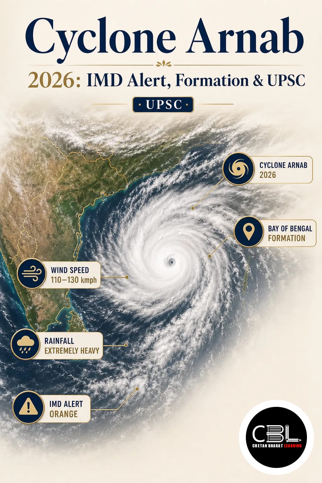

Cyclone Arnab intensified into a Very Severe Cyclonic Storm (VSCS) over the west-central Bay of Bengal in October 2026, prompting major weather warnings for Andhra Pradesh and Odisha. The India Meteorological Department (IMD) forecast destructive winds, extremely heavy rainfall and coastal flooding as the system approached the Andhra Pradesh–Yanam coast on 28 October. The cyclone highlights the importance of tropical cyclone formation, Bay of Bengal geography and disaster preparedness for UPSC examinations. Explore related topics in the daily current affairs archive.
Location and Key Features
Cyclone Arnab developed over the east-central and adjoining southeast Bay of Bengal before moving towards India’s eastern coastline. The system gradually strengthened while travelling westwards and subsequently west-northwestwards over warm ocean waters.
The IMD classified the storm as a Very Severe Cyclonic Storm, a category associated with maximum sustained surface winds of 118–166 km/h. This classification reflects wind intensity rather than rainfall alone.
According to an IMD bulletin, at 11:30 PM IST on 27 October 2026, the cyclone was centred approximately 50 km east-southeast of Narsapur and 70 km south of Kakinada in Andhra Pradesh. The agency projected landfall close to the southern side of Yanam during the early hours of 28 October, with sustained winds of 125–135 km/h and gusts reaching 150 km/h.
The system threatened low-lying coastal settlements, fishing communities, agricultural land, transportation networks and electricity infrastructure. Andhra Pradesh faced the principal landfall risk, while Odisha and neighbouring inland states were also vulnerable to heavy rainfall.
Source: IMD official sea-area cyclone bulletin.
Why in News?
The IMD issued a red-message cyclone warning as the storm intensified over the Bay of Bengal. The alert prompted authorities in Andhra Pradesh, Odisha, Telangana and neighbouring regions to review disaster preparedness and emergency response arrangements.
On 26 October 2026, the National Crisis Management Committee (NCMC), chaired by the Cabinet Secretary, reviewed preparedness across potentially affected states. Authorities prepared evacuation shelters, district control rooms and response teams.
The NDRF and SDRF were placed on standby, while fishermen received warnings against venturing into dangerous waters. The emergency response illustrates the importance of advance forecasts in reducing cyclone-related casualties and infrastructure damage.
Source: Press Information Bureau: NCMC cyclone preparedness review.
How Do Tropical Cyclones Form?
Tropical cyclones are intense rotating low-pressure systems that develop over sufficiently warm tropical oceans. Their formation requires atmospheric instability, abundant moisture and favourable wind conditions.
- Warm ocean waters: Sea-surface temperatures generally above 26.5°C provide energy through evaporation and latent heat release.
- Low-pressure disturbance: Converging surface winds carry moisture towards the developing storm centre.
- Coriolis force: Earth’s rotation produces the deflection necessary for cyclonic circulation away from the equator.
- Low vertical wind shear: Limited change in wind speed and direction with altitude helps preserve the storm’s organised structure.
- Moist mid-troposphere: Sufficient atmospheric humidity supports deep convection and persistent cloud development.
- Upper-level divergence: Outflow near the storm top removes rising air and helps maintain the central low-pressure system.
As warm, moist air rises, water vapour condenses and releases latent heat. This heating promotes stronger convection, falling surface pressure and intensifying winds.
In the Northern Hemisphere, tropical cyclones rotate anticlockwise. In the Southern Hemisphere, they rotate clockwise because the Coriolis force acts in the opposite direction.
IMD Classification of Cyclonic Disturbances
The India Meteorological Department classifies cyclonic disturbances over the North Indian Ocean according to their maximum sustained surface wind speeds. Understanding these categories is important for geography and disaster management questions.
| Classification | Wind Speed |
|---|---|
| Depression | 31–49 km/h |
| Deep Depression | 50–61 km/h |
| Cyclonic Storm | 62–88 km/h |
| Severe Cyclonic Storm | 89–117 km/h |
| Very Severe Cyclonic Storm | 118–166 km/h |
| Extremely Severe Cyclonic Storm | 167–221 km/h |
| Super Cyclonic Storm | 222 km/h or above |
Prelims fact: The IMD uses maximum sustained surface wind speed for cyclone classification. Rainfall intensity, storm surge and coastal vulnerability require separate assessments.
Naming of Tropical Cyclones
Tropical cyclones over the North Indian Ocean are named through a regional arrangement under the World Meteorological Organization (WMO)/ESCAP Panel on Tropical Cyclones. The Regional Specialised Meteorological Centre in New Delhi, operated by the IMD, assigns names from the approved list.
The panel comprises 13 members: Bangladesh, India, Iran, Maldives, Myanmar, Oman, Pakistan, Qatar, Saudi Arabia, Sri Lanka, Thailand, the United Arab Emirates and Yemen.
The name Arnab, meaning ocean or sea in Bengali, was contributed by Bangladesh. The name came from the pre-approved regional list of tropical cyclone names adopted in 2020.
Names improve public communication, reduce confusion when multiple storms develop and support international coordination. They do not indicate the nationality of a cyclone or the country where it will make landfall.
Ecological and Strategic Significance
The cyclone underscores the post-monsoon vulnerability of India’s eastern coastline. October and November form an important period for tropical cyclone development over the Bay of Bengal.
Warm waters, favourable atmospheric circulation and changes in monsoon conditions can support cyclone intensification during this period. The densely populated coastal plains of Andhra Pradesh and Odisha face considerable exposure to strong winds, flooding and storm surges.
The Bay of Bengal is generally more cyclone-prone than the Arabian Sea, particularly for systems threatening India’s eastern coast. Its geographical configuration and extensive low-lying deltas can amplify coastal inundation risks.
Effective cyclone management also demonstrates the value of meteorological satellites, ocean observations, numerical weather prediction and early-warning communication. These technologies can guide evacuation and emergency planning before severe weather reaches populated areas.
Threats and Potential Impacts
- Extreme rainfall: Intense precipitation can trigger urban flooding, waterlogging and riverine flooding in vulnerable districts.
- Storm surge: Abnormally elevated sea levels can inundate low-lying coastal settlements and agricultural fields.
- Strong winds: Cyclonic winds can damage houses, electricity lines, communication towers and transport infrastructure.
- Agricultural losses: Heavy rainfall and saline-water intrusion may damage standing crops and reduce soil productivity.
- Livelihood disruption: Fishing restrictions, damaged boats and interrupted transport can affect coastal household incomes.
- Cascading disasters: Rainfall may trigger landslides, flash floods and prolonged service disruptions beyond the coastal landfall zone.
Storm-related damage depends on more than cyclone intensity. Landfall location, exposure, preparedness, construction quality and local geography strongly influence disaster outcomes.
Conservation and Policy Measures
Disaster risk reduction requires an integrated approach involving the IMD, National Disaster Management Authority (NDMA), National Disaster Response Force (NDRF), state authorities and local administrations.
- Early-warning systems: Improve forecasting, impact-based alerts and multilingual communication to vulnerable communities.
- Planned evacuation: Identify safe shelters, transport routes and priority assistance for elderly persons, children and other vulnerable groups.
- Coastal ecosystem protection: Conserve mangroves, dunes and wetlands that can contribute to coastal hazard reduction.
- Resilient infrastructure: Strengthen electricity networks, roads, housing and public facilities against extreme winds and flooding.
- Community preparedness: Conduct evacuation drills and train local volunteers in first response and emergency communication.
- Interstate coordination: Coordinate weather alerts, transport management and disaster assistance across affected regions.
India’s approach increasingly emphasises early warning, early action and resilient recovery. The experience of Cyclone Arnab illustrates the need to integrate scientific forecasting with timely administrative decisions.
For broader environmental and disaster management preparation, consult the CBL current affairs platform and official updates from the National Disaster Management Authority.
Punjab PCS and Haryana HCS aspirants should prepare the formation, classification and naming of tropical cyclones under Indian Geography. Although Punjab and Haryana are inland states, the principles of early warning, evacuation, district disaster management and infrastructure resilience apply to floods, thunderstorms and other regional hazards. The role of IMD, NDMA, NDRF and state disaster management authorities is especially relevant for General Studies.
Frequently Asked Questions
What was Cyclone Arnab and where did it develop?
Cyclone Arnab was a tropical cyclone that developed over the Bay of Bengal in October 2026. It intensified into a Very Severe Cyclonic Storm and approached the Andhra Pradesh–Yanam coast.
Who named Cyclone Arnab?
Bangladesh contributed the name Arnab to the approved North Indian Ocean cyclone naming list. The IMD’s Regional Specialised Meteorological Centre in New Delhi assigns names according to the regional sequence.
Why are tropical cyclones important for UPSC examinations?
Tropical cyclones are important for Physical Geography, climatology, natural hazards and disaster management. UPSC questions can cover formation conditions, cyclone naming, wind classifications, storm surges and India’s disaster response institutions.
Related Current Affairs
Preparing for UPSC, PCS or HCS?
Talk to a mentor at Chetan Bharat Learning, Chandigarh. Free guidance on choosing the right exam and building a study plan.
Chat on WhatsAppCall 97793 53345UPSC / IAS / PCS coaching in Chandigarh · Trusted by aspirants across Punjab & Haryana
Leave a Reply
You must be logged in to post a comment.